

We recently did some off-road exploring and camping in the Guadalupe Mountains of Texas and New Mexico. The eight-day trip took us from the old Butterfield Stage-stop at the Guadalupe Mountains National Park, on toward Dell City, TX, where we made our way around the Brokeoff Mountains and climbed up into the national forest in New Mexico. Our route was loosely-based on one listed on Overland Trail Guides.
Although the info on the route was very useful, it was outdated in some spots where the trail had become overgrown by thick brush and tall grass.
We found heavy mesquite up to 3″ in diameter grown over some trails listed in this route, so we had to backtrack to county roads. Getting a bit lost did lead us to the interesting old stone and adobe dugout home in the photo below, whose roof was made from ocotillo stems, dirt and rocks.
Old Dugout Home in Desert


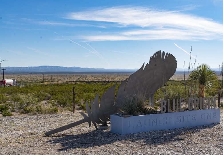
The photo below is a bit out of sequence as far as the trip goes. This is where some of your dollars go when you buy on Amazon and also where William Shatner finally got to go into outer space. The Blue Origin Launch Site 1 is located about a half an hour south of the National Park entrance on the Texas side, on SH-54 heading up from Van Horn.
Salt Basin Dunes in Guadalupe Mountains National Park
Because of the dirt road, which can become exceptionally slick and rutted after a rain, few visitors to the national park ever visit Salt Basin Dunes. We parked and hiked for about a half an hour to the edge of the dunes, which was well worth the effort. The dunes cover about 2,000 acres and were created over thousands of years because of a geological effect called a graben, or down-dropped block of the earth’s crustal rocks, which filled with water and became a large salty lake, which evaporated later on.

The Salt Wars
In 1854, the salt basin west of the Guadalupe Mountains was the site of a bloody series of battles which were dubbed the “Salt War”. The salt basin, or Guadalupe Salinas, had long been considered public domain, with families coming up from Mexico with wagons to collect the precious resource. New landowner, James Magoffin, confronted a small party of salt collectors and assaulted them with what was considered to be excessive force. The brutal massacre ultimately led the State of Texas to once again declare much of the basin as public property. More on the history of the Guadalupe Salinas can be found here on the NPS website.
Below: A longhorn cow looks at us with suspicion en route to the dunes.

Climbing Up Into The Lincoln National Forest
From the Salt Basin Dunes, we took Williams road back to FM-1576 and tried to follow a route for which we’d downloaded a GPX file, but it didn’t pan out. Backtracking over lots of mesquite thorns, we ended up on the farm road up to the New Mexico state line. Here, we caught a road labeled G-6 to G-8, then G-14, which began climbing into the mountains. The gravel county road was well-maintained, not something we really seek out, but which was nonetheless welcome when trying to make up the several hours we lost searching for the trail in open-range country.


Buck Vista – Below – is on the Queens Highway, NM-137.


Just past El Paso Gap on NM-137, we turned right and entered through a closed gate onto Kuykendall road and into National Forest land. Thankfully, this drought-stricken area has seen some rain lately, but there were several long mudholes to cross, all with a rocky bottom less than a foot under the mud. We don’t recommend this part of the route on lesser forest roads for anything other than high clearance vehicles.


Camped For The Night
For those looking to overland in the Lincoln National Forest, be advised that November is hunting season. To avoid bothering the hunters, we camped early that afternoon and didn’t leave our campsite the next day until almost noon. We passed a couple hunters on ATV’s, all empty-handed on the last day of deer season.

Next Segment of Trip Continues on Part 2.
Nearby Attractions: McKitrick Canyon Hike
Note: Be sure to verify all route information before setting out on this or any other route. You can contact the Lincoln National Forest Ranger District at 575-434-7200 for updates on conditions and restrictions.


