

This post is a continuation from part one of our off-road camping trip in the Guadalupe Mountains of New Mexico. Because it was hunting season, the “woofs” stayed home this time for safety.
Dispersed Camping in The Lincoln National Forest
According to the U.S. Forest Service, dispersed camping is allowed in the Lincoln National Forest, including the Guadalupe Ranger district where we spent just over a week. Regarding camping, the US Forest Service website states that “You may drive to park your RV no more than 300′ from an open road designated for such use.” Just be aware that November is hunting season, which continues until Jan 1 for some game animals. Non-hunters should still always wear blaze orange clothing and be aware that in this “land of many uses” – as the forest service calls it – one should be very cautious this time of year!
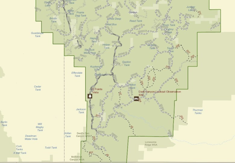
Route to Dark Canyon Fire Tower
From our campsite just off Kuykendall road, we traveled on to the Dark Canyon fire tower via Klondike road to Cougar Road, and then Dark Canyon road, winding our way through private land in Goat Canyon as we climbed up toward the ridge, where the fire tower sits.

Fossilized beach sand ripples from an ancient ocean that once existed here.
Fossilized Beach Sand Ripples
The Guadalupe Mountains are home to some of the most interesting geological features found on Earth. According to the USGS, part of these mountains – El Capitan and Capitan Reef – make up what is considered to be the world’s largest fossil coral reef, formed during the Permian era, in an environment not unlike that of the Bahamas today. We felt as if we were literally driving along the “sands of time” as we traversed Dark Canyon road, whose surface consists of fossilized ripples from an ancient beach that once existed here millions of years ago.


Dark Canyon Fire Tower History
The Dark Canyon fire tower site has been in use since 1910, starting with a platform built up in tall trees, serving as the watchtower, with long ladders for access. In 1949, the forest service erected a 48′ steel tower with an Aermotor MC-99 type 7’ X 7’ cab on top. The Dark Canyon fire tower is one of only two like in left in the US, the other being in the Kaibab forest. An old living quarters and some outbuildings at the site seemed to be in excellent condition, despite the harsh weather conditions.
We noticed that even the smallest of these had lightning rod systems installed, so camping up this way during the rainy season would not be advised.
We climbed the stairs up to the tower (didn’t see any signs saying it wasn’t allowed) but found the access door to the upper cabin to be locked. The view from that point was still amazing, and we spend some time messing around with our handheld ham and GMRS two-way radios. We were amazed by how far our 5 watt handheld radios could reach out from up there.

Camping on Guadalupe Ridge
We camped for two nights up on the ridge, which isn’t really recommended because of the high winds that often sweep up from the desert below. Instead of setting up our rooftop tent, we just slept in the rear of the double-cab, where we have removed the rear seat. We could feel the wind rocking the truck pretty hard at night, so were glad we opted out of tent camping.


Queen of The Guadalupes Cave – Guadalupe Mine
The next morning we drove toward Guadalupe Mine, the site of some early-day prospecting activity at the entrance to a natural cave, listed on a USGS benchmark on a rock near the entrance as “Queen of the Guadalupes Cave”. We couldn’t find much about this cave online, beyond a brief description in an old publication of the New Mexico Bureau of Mines and Mineral Resources.
This lists the cave as a “60 meter deep vertical-shaft complex which underlies limestone containing a gossan mass of hydrated iron oxide.” Along the side of the cave/mine we observed many reddish-colored rocks laden with minerals, including some with exposed pyrite or “fools gold” which must have lured the early miners.

To explore some more of the ridgeline (there didn’t seem to be much hunting activity up this way compared to other areas), we spent another night camped near the mine/cave (300′ away as required). This location wasn’t quite as windy as the last, but we’d still not recommend tent camping at this spot. The night sky was amazingly clear; however, it was far too windy to try night photography using a tripod.
This post is Continued on Part 3.
Note: Be sure to verify all route information before setting out on this or any other route. You can contact the Lincoln National Forest Ranger District at 575-434-7200 for updates on conditions and restrictions.
Sources:
https://en.wikipedia.org/wiki/Guadalupe_Mountains
https://www.fs.usda.gov/main/lincoln/about-forest/districts
https://www.fs.usda.gov/recarea/lincoln/recarea/?recid=34226
https://www.nps.gov/parkhistory/online_books/geology/publications/state/nm/1987-117/sec9-1.htm
https://www.nps.gov/parkhistory/online_books/geology/publications/state/nm/1987-117/sec9-1.htm


